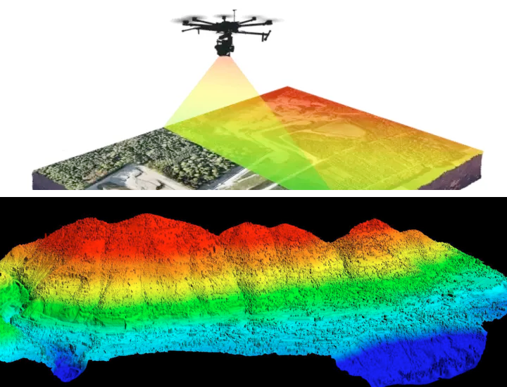
LiDAR Drone
LiDAR drone technology has revolutionised the way aerial mapping and surveying are conducted, especially when combined with the capabilities of unmanned aerial vehicles (UAVs). LiDAR drone services offer a powerful solution for gathering high-resolution data over large areas in a short amount of time.
The benefits of drone LiDAR services include rapid data acquisition, allowing for efficient collection of large-scale data over expansive areas. This saves valuable time and resources compared to traditional surveying methods.
Drone LiDAR scanners are versatile and cater to a wide range of industries including surveying construction sites, monitoring vegetation health, assessing forestry, conducting environmental monitoring, or inspecting infrastructure
Drone Magnetic
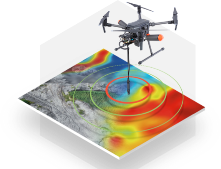
Magnetic and other geophysical surveys have always been challenging. They have traditionally involved the use of heavy, expensive equipment in hilly & inaccessible areas. Traditionally, the options were limited to walking with a ground-based magnetometer (slow) OR flying a de-magnetised helicopter (expensive).
Drones have changed the Game
In the last 5 years, drones and airborne magnetometers have changed the game. Now a traditional magnetic survey can be conducted 5x faster and 10x cheaper using a magnetometer-mounted drone. Not only is the survey faster and more affordable, but it also results in higher resolution data collection as the drone (UAV) can be flown much closer to the surface as compared to a helicopter.
Above all, drone magnetic surveys offer a safe and reliable way of acquiring geophysical data even in the most inaccessible terrain.